Tour time (allow 5-7 days)
MAP

Map reproduced by grateful permission of Microsoft
Background
My guide to the whitehorse walk is available, although not as glossy it contains much more info and is only Ł1 inc P&P and it offers much better views and visits more sites, its got to be worth Ł1.
This a recent addition to the long distant walks club, and obviously I was not involved as some interesting sites and the new hillfigure at Charlton has been bypassed when it could have easily been included. You pass the wrong side of the hill although you can easily take a short detour to see it and rejoin the path, no extra distance is required. And the still visible old Devizes horse
A guide is available from Wiltshire County Council but at Ł6 it is a bit expensive and is confusing. It consists of a series of 8 walks written on separate papers with a scale of 1:77,000 (reduced scale landranger maps) and a short route description. The walks link together to form the walk.
Why not use 1:25,000 maps that the ordnance survey have recently updated or actual landranger maps that are reproduced in most long distance walks? The landranger Explorer map references are given. They are on waterproof paper, an indication of the weather in the area perhaps?
There is very little information about the horses which is the major failing of this guide. If only they asked me.
My guide to the whitehorse walk is available, although not as glossy it contains much more info and is only Ł1 inc P&P.
The guide urges you to use public transport to get there, but as with all rural areas it is very poor, late, and infrequent and not at all timed for this sort of thing. I have done a lot of walking in the area and have occasionally used public transport and had all sorts of problems, use a car or plan very carefully bus timetables are also available from Wiltshire CC as are accomodation lists but make sure to book well in advance as some places do not have lots of places to stay.
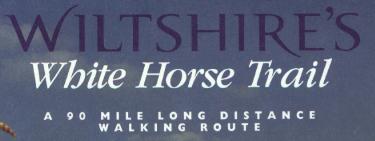
The walk is 90 miles long on fairly good paths and a few interesting places are also visited on route, some parts of the Ridgeway are followed on the route.
The circular route is waymarked with the signs depicted below, and the sections I have walked they are fairly good. They are setup for the walk to be followed anticlockwise, and this is supposed to offer the best views of the horses, but in reality it doesn't. There are supposed to be information boards although I have only found one so far, they may well be in place when you do the walk. The distances between horses varies from 8 miles to 27 miles and when you walk this it should probably be broken up a bit more evenly.

Directions
Land ranger map nos 173, 183, 184 are needed I will write a more comprehensive account when I complete the walk.
This is the outline from the guide, narrative is mine not copied.
Circular Walk
Walk 1 Westbury to Pewsey 23 miles
A long day but can be completed in one go, the route leave the Westbury horse at Bratton Camp and continues up the hill and along the top before dropping down and after a mile or so passes through the Firing Ranges. it climbs back up above Eam's cliff and along the top again through firing ranges for several miles to Charlton. Just before Charlton, where the path meets the road at a pub, here you can follow the road to the left and walk 500m the Wyvern is on your left. A good viewpoint is Coome Cottage. The path goes through Charlton, stays at low level and goes through Manningford Bruce and along the face of Pewsey Hill, not the best view of the horse, there were alternatives. You then climb up to the Pewsey horse.
Walk 3 Pewsey to Marlborough (11 miles)
Not the most direct route but well worth the diversion, the route heads north from Pewsey, towards Oare, where you climb to the giants grave. You drop down and pass lots of earthworks, long barrows before passing through West Woods climbing up Graham Hill before dropping onto the Marlborough Horse, again the view of the horse is poor (most horses face North-ish so approach from south is not ideal).
Walk 4 Marlborough to Broad Town (11 Miles)
This walk leaves Marlborough and instead of passing the interesting sarsen stones (there are paths) and other interesting things to see along an almost parallel path to Overton Down to pick up the Ridgeway a little further down, but the path passes through some uninteresting areas. Follow the Ridgeway to the Hackpen Horse again approached so that the view is poor. The route goes parallel to the road to Broad Hinton. The route goes to Bincknall Castle an Ironage Hillfort. Then along the base of the hill to the Horse again poorly approached.
Walk 5 Broad Town to Cherhill (9.5) miles
From the Horse in Broad Town, the path follows the ridge and drops into the village, follows a low leve route to Clyffe Pypard where there is a pub and then into Highway, up Highway hill and across the top to drop into Cherhill then up Cherhill Down to the Cherhill Horse.
Walk 6 Cherhill to Alton Barnes 8.5 or 11 miles depending on route, via Wansdyke and Devizes horse or Avebury
The Wansdyke route heads south from Cherhill and picks up a roman road - the Wessex Ridgeway, at Morgans Hill the route splits and a detour to the Devizes New Horse or continue on the route down the Wansdyke several miles to Milk hill and drop onto the Alton Barnes horse again poor views.
The alternative route heads east from the horse picking up a different section of the Wessex Ridgeway, before heading north to Windmill Hill and then south into Avebury (well worth spending a little time here) follow the route south to Silbury hill and a short detour can be made to visit the West Kennet Long Barrow before heading to the Sanctuary, east Kennet Long Barrow (just a little way off the path. The route joins the end of the Wansdyke and down to the horse.
Both routes are interesting and I would do both at some stage, but if you have not visited the area before take the Avebury route.
Walk 8 Alton Barnes to Westbury via Devizes Horse (27.25 miles)
The walk goes from the Alton Barnes horse then thorugh Alton Barnes, along the canal to Devizes, detours the the Devizes New Horse, the old horse is 10 min walk from the new horse and well worth the visit. The route continues along the canal then heads south to Bulkington, through Steeple Ashton and Into Bratton and up the hill to the Westbury Horse. This is a little long for most people in one day and should probably be split into two days.
Some Shortcuts which really confuse the walk / guide
Walk 2 Pewsey to Alton Barnes (shortcut) 8.25 miles
A rather meaningless diversion, going direct from Pewsey to Alton Barnes avoiding Marlborough, Hackpen, Broad Town and Cherhill horses, complete madness throw this sheet away or give it to a friend to do a day walk with.
Walk 7 Alton Barnes to Pewsey 8.25 miles
This is just the reverse of the above walk and I can't see why the last sheet was included so this sheet is beyond comprehension, just padding it out for your Ł6 I suppose.
Summary
I have been rather scathing because the route is sometimes stupid avoiding interesting sites when there are obvious routes that could have been taken, and most of the approaches to the horses are poor, having walked may of the sections or parts of I would walk clockwise and this gives much better views of all the horses (Cherhill a little worse and Westbury is the same).
My route is much better and follows this walk to a large extent but offers alternative route to see some interesting sites and approaches the horse offering the best views.
Get it here My guide to the whitehorse walk is available, although not as glossy it contains much more info and is only Ł1 inc P&P.